Aerial Photography of Burley District over the years
Includes: Burley Woodhead, Stead, Burley Moor & Burley in Wharfedale.
Oblique views and Vertical or Satellite images.
Oblique views and Vertical or Satellite images.
1937
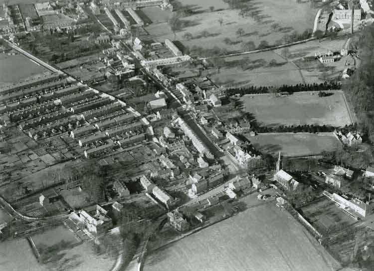
1937 Aerial Image Burley in Wharfedale - Looking West. Image courtesy of John & Yvette Horton Collection in Burley Archive.
The above 1937 oblique aerial image of Burley in Wharfedale taken from John Horton's print of C. H. Wood (Bradford) original.
1948 - Historic England RAF aerial image (RAF_541_32_RP_3094)
The RAF image above shows Scalebor Park Hospital bottom left and Carr Bottom Reservoir top right.
1954 Aerial Image below of Scalebor Park Hospital & its surroundings. Moor Lane runs left to right across the bottom. The Otley & Ilkley Joint Railway from middle right up to top left.
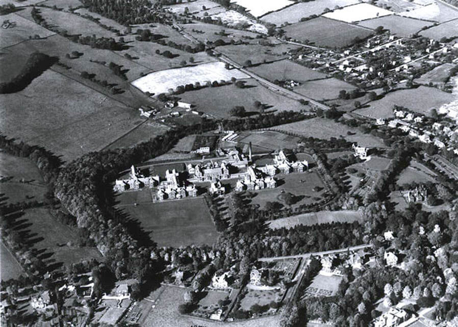
1954 Aerial Image Scalebor Park Hospital, Burley in Wharfedale and surroundings. Image courtesy of Burley Archive
c1960
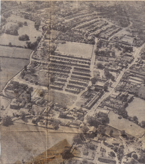
c1960 Aerial Image Burley in Wharfedale from a newspaper cutting. Image courtesy of Burley Archive
The above aerial image from c1960 has Burley Hall at the bottom edge, looking west. The image is taken from a newspaper cutting of unknown origin. The demolition of parts of Burley in Wharfedale by Ilkley Urban District Council has begun.
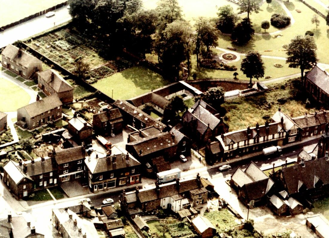
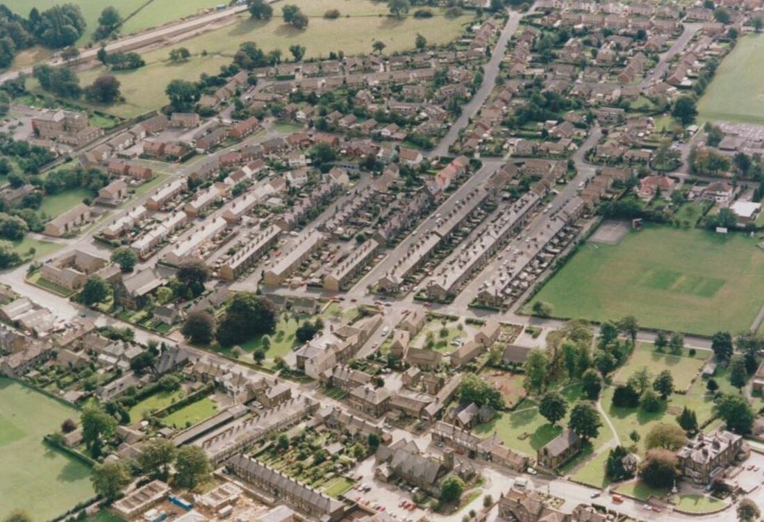
1960s Oblique aerial image Main Street and its environs, Burley in Wharfedale. Image courtesy of Burley Archive.
The above 1960s oblique aerial image of Burley in Wharfedale shows part of Main Street (east). The shop to the left of centre is Darbysons at 79 to 83 Main Street, Burley in Wharfedale.
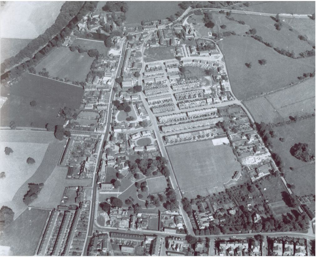
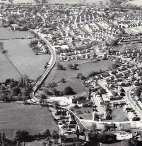
1964 Oblique Aerial Image of Burley in Wharfedale - Looking East. Image courtesy of John & Yvette Horton Collection in Burley Archive.
The above 1964 oblique aerial image is of Burley in Wharfedale looking east. Station Road runs along the bottom of the image to its junction with Main Street.
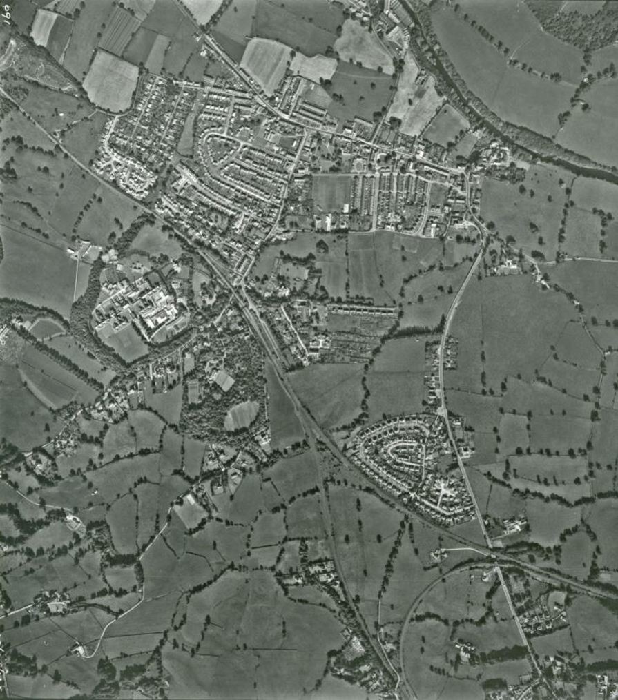
1965 Aerial Photograph Vertical or Satellite View of Burley in Wharfedale. Image courtesy of Burley Archive.
The above 1965 vertical or satellite image has the outer edges of Menston at the bottom, Burley in Wharfedale at the top. The Otley & Ilkley Railway is at the lower right & cuts diagonally across the image. The River Wharfe is at top right. Scalebor Park Hospital is to the left of centre.
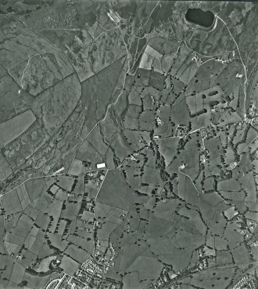
1965 Aerial Photograph Vertical or Satellite View of Burley Woodhead and Burley Moor. Image courtesy of Burley Archive.
The above 1965 vertical or satellite image show the outer edges of Menston at the bottom, with Moor Road & Burley Woodhead going from left to right across the centre of the image. Carr Bottom Reservoir on Burley Moor is the dark area at the very top of the image
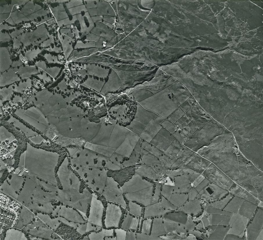
1965 Aerial Photograph Vertical or Satellite View of Burley Woodhead, Robin Hole, Stead and Burley Moor. Image courtesy of Burley Archive.
The above 1965 vertical or satellite image shows the junction of Moor Lane & Moor Road, Burley Woodhead at the top left of the image. The fields of Stead are the bottom right & Robin Hole is the wooded area near the centre of the image. Burley Moor is the top right hand portion of the image with Coldstone Beck running diagonally across it to Robin Hole.
1977 - 4 views of Burley in Wharfedale courtesy of the John & Yvette Horton Collection in the Burley Archive
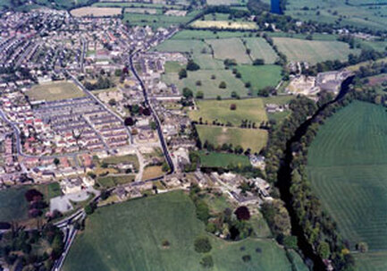
|
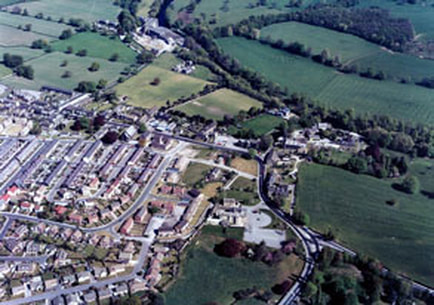
|
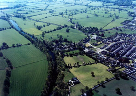
|
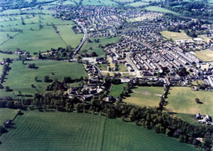
|
1980s Aerial photograph of Burley-in-Wharfedale. Image courtesy of Wharfedale Observer.
The above 1980s oblique aerial image of Burley in Wharfedale, has Bradford Road running north south on the left of the image. Main Street (east) sweeps round from the junction at Burley House & runs left right across the bottom of the image.
1995 Aerial Image Burley in Wharfedale - Looking South East. Image courtesy of John & Yvette Horton Collection in Burley Archive.
The above 1995 oblique aerial image of Burley in Wharfedale, shows Burley Grange at the bottom right corner, with Main Street (east) running diagonally across the bottom. Bradford Road is shown at the top left of the image.
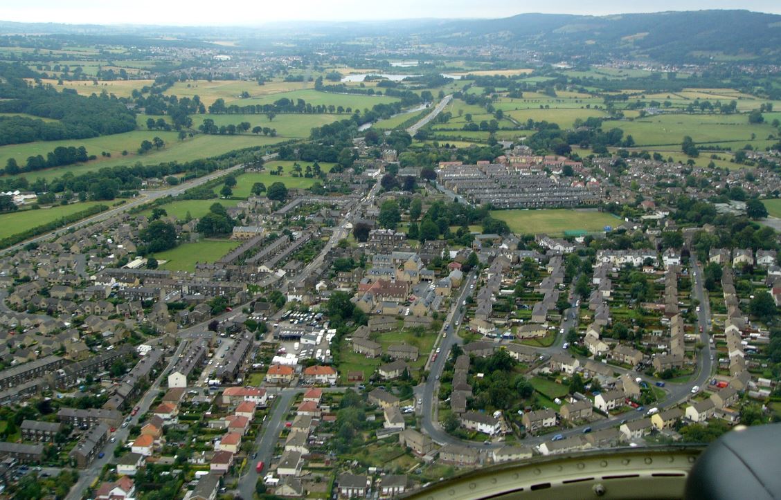
2003 Aerial Image Burley in Wharfedale. Image courtesy of Burley Archive.
The above 2003 oblique aerial image of Burley in Wharfedale, views the town looking south. The by-pass (A65) runs diagonally across the bottom. Right of centre & near the top is Scalebor Park.
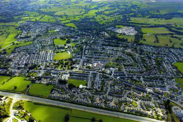
2006 Aerial Image Burley in Wharfedale - Looking East. Image courtesy of Harvey Bosomworth Collection in Burley Archive,
The above 2006 oblique aerial image of Burley in Wharfedale, looks west to east, with the Burley by-pass (A65) running diagonally from the left edge towards the upper centre of the image. The green area to the centre & right of the image is Hodson Park, home of Burley in Wharfedale Cricket Club & once the home of Burley in Wharfedale Women's Cricket Team "The Greenholme Girls".
Burley Community Library & Burley Archive, Grange Road, Burley in Wharfedale, West Yorkshire England LS29 7HD
Opening Times: Monday, Tuesday and Friday 10.00am to 5.00pm, Thursday 2.00pm to 7.00pm, Saturday 10.00am to 1.00pm. Closed Wednesday & Sunday
Burley Archive & Local History Group: Drop-In Sessions Friday 2.30pm to 4.30pm. For other times please contact us
Burley Archive & Local History Group: Drop-In Sessions Friday 2.30pm to 4.30pm. For other times please contact us
